This site uses cookies to improve your experience. To help us insure we adhere to various privacy regulations, please select your country/region of residence. If you do not select a country, we will assume you are from the United States. Select your Cookie Settings or view our Privacy Policy and Terms of Use.
Cookie Settings
Cookies and similar technologies are used on this website for proper function of the website, for tracking performance analytics and for marketing purposes. We and some of our third-party providers may use cookie data for various purposes. Please review the cookie settings below and choose your preference.
Used for the proper function of the website
Used for monitoring website traffic and interactions
Cookie Settings
Cookies and similar technologies are used on this website for proper function of the website, for tracking performance analytics and for marketing purposes. We and some of our third-party providers may use cookie data for various purposes. Please review the cookie settings below and choose your preference.
Strictly Necessary: Used for the proper function of the website
Performance/Analytics: Used for monitoring website traffic and interactions
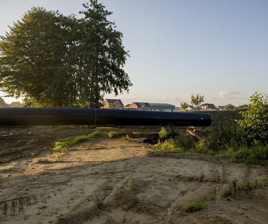
This involves assessing the lands suitability for construction, identifying any legal restrictions, and understanding the surrounding infrastructure. Land surveys are an essential component of this phase. Professionals like land surveyors play a pivotal role in providing the data and insights needed to create effective plans.
This piece explores the importance of usingmaps that showcase property ownership specifics, emphasizing the benefits and uses across various fields. The use of property owner maps provides information on ownership trends, helping buyers locate property owners in a given area.
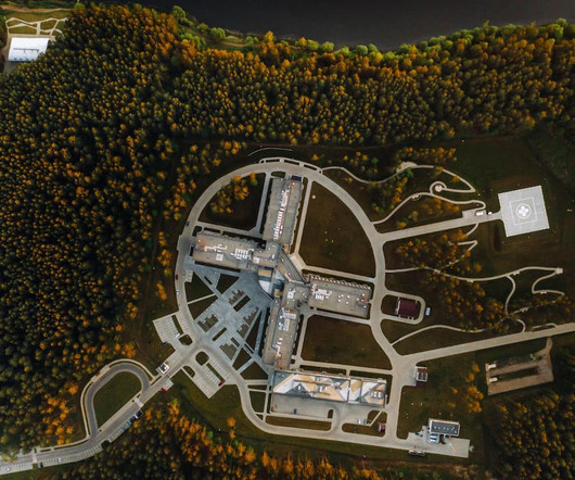
In simplest terms, to get environmental approvals, agency regulators need the answers to three questions: What resources are at the site? This part of the process uses all the tools available, such as Geographic Information System (GIS) mapping, boots-on-the-ground specialists, and drones. What are the potential effects?
Drone mapping has become a valuable tool in construction, changing how projects are planned and carried out. By taking high-quality images of the land and site conditions, drone mapping helps identify and address potential problems early in the project. Switching from manual surveys to drone mapping greatly improves efficiency.
Polly Osborne Designers / Specifiers / Landscape Architects Engineers Architects Regulations Biophilic Design Sustainable Development Sustainable Design and Construction Urban Planning When we spend time in nature, we instinctively feel its value. There’s more focus than ever on the environmental impact of construction projects.
There are a lot of specialisations within the surveying profession though, so we thought a comprehensive list of the types of surveyors and a brief summary of what each kind does would be useful. A surveyor is a professional who specialises in measuring, analysing and mapping the physical features of a property. What is a Surveyor?
Photo by Pixabay: www.pexels.com "Using drones in construction is no longer futuristic but a reality that is reshaping the industry." Using drones in construction is no longer futuristic but a reality that is reshaping the industry.
Growth-focused land development companies set out to create a successful landscape. Conduct market research Expertise is indeed power in the field of land development. Invest in strategic planning Land development is a complicated industry, but you can succeed with every move carefully planned.
Using pavers and concrete finishes can make your deck and patio flow smoothly together. This mix not only makes your outdoor space look better but also makes it more useful. Let’s explore how to make the most of your outdoor space using paving stones and driveway pavers. Use matching materials for a cohesive appearance.
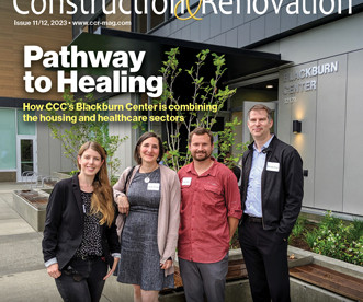
The park expands Arlington County’s ability to meet Chesapeake Bay Watershed regulations while cultivating native plants and providing new boardwalk areas and fresh interpretive designs.
Traditionally, farmers would use large machines or even do it by hand, which took a lot of time and effort. This not only saves time but also reduces the amount of chemicals used, helping the environment and lowering costs. Traditional methods, such as using tractors or manual labor, take a lot of time, especially in large fields.
One of the most basic requirements for anyone purchasing or developing land is environmental due diligence. ESAs are designed to limit your liability under the Comprehensive Environmental Response, Compensation, and Liability Act (CERCLA), also known as Superfund, and state regulations.
Whether you’re designing a residential property, a commercial complex, or a public infrastructure project, having an accurate depiction of the land’s features can make a significant difference in the success of your project. A topographical survey is a detailed and precise mapping of the physical features of a piece of land.
According to a study by Princeton University, new flood maps show ‘100-year’ floods may now occur annually along the southeast and Gulf of Mexico coasts, or every one to 30 years. As land is expensive real estate, designers are turning to the many rooftops, which make up 20 to 25 percent of the land area in major North American cities.
According to a study by Princeton University, new flood maps show ‘100-year’ floods may now occur annually along the southeast and Gulf of Mexico coasts, or every one to 30 years. As land is expensive real estate, designers are turning to the many rooftops, which make up 20 to 25 percent of the land area in major North American cities.
This may include measuring land features, assessing environmental conditions, and evaluating existing structures. Site surveys are essential for ensuring that projects are feasible, compliant with regulations, and designed to meet the needs of stakeholders. This may include: Topographical Surveys : Mapping the land’s surface features.
In construction, environmental regulations generally focus on stormwater, waste disposal, hazardous waste handling, and air quality. FWS offers a variety of resources for contractors, engineers, and project owners, including an interactive map tool that allows users to identify potential impacts and review suggested conservation measures.
The building’s strategic design includes a 35 percent targeted reduction in potable water use through efficient fixtures and equipment, a 25 percent targeted reduction in energy costs with a focus on thermal performance and optimal heating, and a 360-panel floating solar array to name a few. 2 | SMR-ISD Consulting Structural Engineers, Inc.
This area is pivotal for various businesses and organizations, supported by its careful planning and zoning regulations. Furthermore, the integration loop aids in land management, optimizing property use while preserving valuable green spaces. How can I find the map for 4222 Integration Loop area?
The Districts Stormwater Management Regulations stipulates construction sites achieve retention of the rainfall from a 1.2-inch The first step for installing the green roof was to map out the specific areas on each roof section that would eventually house the growth media. The redevelopment site The Parks at Walter Reed is a 26.71-ha
But there’s a problem: New infrastructure planning often uses historical flood patterns rather than climate change risk estimates. To predict future flood danger, new infrastructure is often planned using historical data like high-water marks and storm strength. Updates to federal flood maps take years.
The financial breakdown includes costs for land acquisition, construction materials, and labor. Competitive bids for contracts ensure that funding is used effectively. As the overseeing agency, it ensures that all aspects of the construction align with state and federal regulations.
In this article, we’re serving up a construction terminology cheat sheet to demystify the jargon used in the United States (US) and Australia (AU). By using the right words, we can minimize misunderstandings and keep errors at bay. This, however, doesn’t hinder the innovative spirit of US construction professionals.
Key Takeaways The Paradise Palms redevelopment is a $300 million project focused on mixed-use development. Zoning and Rezoning Process The first hurdle in the Paradise Palms redevelopment involves zoning regulations set by the Cairns Regional Council. It must comply with various local and state regulations.
Application: This standard applies to davits, structures typically used to lower things over an edge. All fall protection equipment is required by OSHA to be checked prior to each use. Do not use defective ladders. This function should be performed once a month, during the time of year that the fireplace is in use.
Providence is in the midst of building a new Innovation and Design District, also known as I-195 land, which will be anchored by the Cambridge Innovation Center (CIC) and Brown University’s School of Professional Studies. The I-195 Redevelopment District Commission voted to authorize $18.5
As a seasoned hunter and landowner, I understand the importance of partnering with the right hunting land management company to maximize your property’s hunting potential and wildlife habitat. Managing predators: applying tactics to regulate predator numbers that could affect the prosperity of your desired animal species.
A central repository of subsurface information would significantly improve Australian infrastructure for Australians that use it and reduce the burden on taxpayers that economically support it. titles), and current and historical landuse. A single source of truth of subsurface information for all projects and actors.
Masterformat is a multiple level data structure consisting of numbers and titles/descriptions used to organize information by “work results” or construction practices. 01 14 19 Use of Site. Land Assessment. Bioremediation Using Landfarming. Bioremediation of Soils Using Windrow Composting. Land Assessment.
Masterformat is a multiple level data structure consisting of numbers and titles/descriptions used to organize information by “work results” or construction practices. 01 14 19 Use of Site. Land Assessment. Bioremediation Using Landfarming. Bioremediation of Soils Using Windrow Composting. Land Assessment.
Across Ohio, there are more than 13 million acres of farmland and over 10 million acres used to grow principle crops of corn, soybeans, wheat and hay. Utt said the equipment and facilities used to produce melons has changed dramatically over the past several decades. To cover their building investment, Hirzel used a VP SSR roof system.
The various combinations of transport are useful for materials import and product export. When shipping on land, Interstate 40 runs from North Carolina on the east to California on the west and runs straight through the middle of Arkansas. Arkansas’ incentives are nationally competitive, understandable and easy to use.
However, achieving truly sustainable construction extends beyond using environmentally friendly materials or optimizing energy consumption. It requires a comprehensive understanding of the surrounding environment, including land characteristics, climate patterns, and resource distribution factors that conventional approaches often overlook.
Key Features Maintains core values of safety, quality and productivity Brings more than 75 years of experience to projects Uses advanced technologies, such as GPS and drones, to optimize product outcomes Gives individualized attention to every project and handles most project details internally to stay on schedule 2.
the bill is supposed to cut federal government energy costs and train the federal building maintenance work force in the use of high performance technologies for energy conservation in federal buildings.”. Qualifications will be mapped automatically to the core competencies that they demonstrate. Oppor tunity: The web-?tool
We organize all of the trending information in your field so you don't have to. Join 79,000+ users and stay up to date on the latest articles your peers are reading.
You know about us, now we want to get to know you!
Let's personalize your content
Let's get even more personalized
We recognize your account from another site in our network, please click 'Send Email' below to continue with verifying your account and setting a password.


Let's personalize your content