This site uses cookies to improve your experience. To help us insure we adhere to various privacy regulations, please select your country/region of residence. If you do not select a country, we will assume you are from the United States. Select your Cookie Settings or view our Privacy Policy and Terms of Use.
Cookie Settings
Cookies and similar technologies are used on this website for proper function of the website, for tracking performance analytics and for marketing purposes. We and some of our third-party providers may use cookie data for various purposes. Please review the cookie settings below and choose your preference.
Used for the proper function of the website
Used for monitoring website traffic and interactions
Cookie Settings
Cookies and similar technologies are used on this website for proper function of the website, for tracking performance analytics and for marketing purposes. We and some of our third-party providers may use cookie data for various purposes. Please review the cookie settings below and choose your preference.
Strictly Necessary: Used for the proper function of the website
Performance/Analytics: Used for monitoring website traffic and interactions
The map highlights infrastructure and transportation improvements that can create greater access to the distressed areas, making them more attractive to investors.
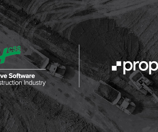
This partnership will integrate Propeller’s powerful mapping and data visualization capabilities with HCSSs suite, including HeavyBid, HeavyJob, HCSS Plans, and HCSS Cloud, creating a seamless experience for joint users.
This partnership underscores Eos commitment to empowering municipalities across Canada with cutting-edge GNSS solutions for smarter, more efficient mapping and asset management. Eos GNSS receivers are designed to empower municipalities to efficiently map and manage critical infrastructure while saving time and resources.
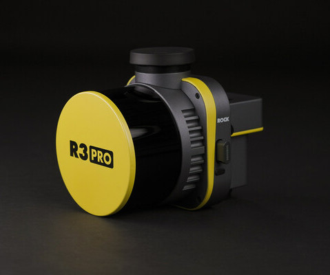
LiDAR technology company ROCK Robotic announced its latest innovative LiDAR mapping system with the launch of the R3 and R3 PRO systems. The R3 launch is the latest effort for ROCK Robotic to offer a user-friendly, end-to-end LiDAR solution to land surveyors and commercial mapping professionals.
Montreux, Switzerland – TOPODRONE, a Swiss based designer and manufacturer of high-precision surveying equipment, recently completed its R&D and released a new drone thermal mapping solution. TOPODRONE PT61 camera can perform detailed surveys and deliver thermal orthomosaic maps obtaining accurate 3D models.
The landmark law has spurred more than $86 billion in project investment, but not all U.S. states are benefiting equally. Here are four takeaways on how the IRA has changed the industry this year.
Construction Dive tracks the top projects focused on products such as semiconductors, EV batteries, food, cars and consumer goods since the CHIPS Act was signed last August.
With nearly $800,000 in grant funding, a team of scientists at UC San Diego are exploring ways to integrate robotics into the building industry and improve 3D modeling and mapping.
Trimble announced today the leading-edge Trimble® MX90 mobile mapping system. With state-of-the-art Trimble GNSS and inertial technology, when combined with Trimble field and office software, the Trimble MX90 provides a complete field-to-finish mobile mapping solution that enables powerful workflows for data capture, processing and analysis.
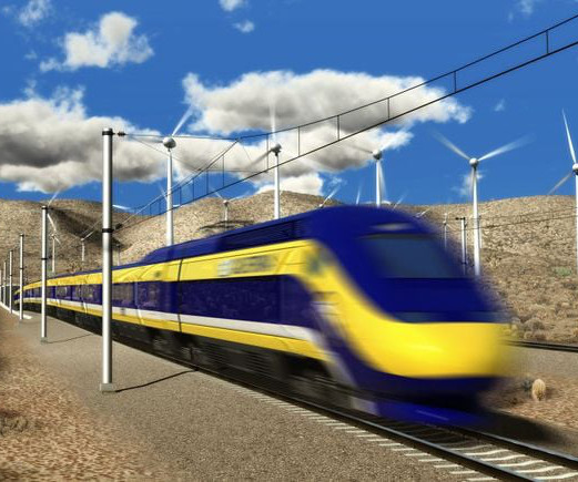
While details on projects such as the state’s infamous high-speed rail project are scant, the map provides a broad overview of the work that is underway.
Aerial photogrammetry data obtained from aerial mapping undergoes data processing to finally interpret the data to emerge 3D models and plans. The data processing is performed using specialized software that possesses the feature to take different aerial mapping data and provide maps and models as the output.
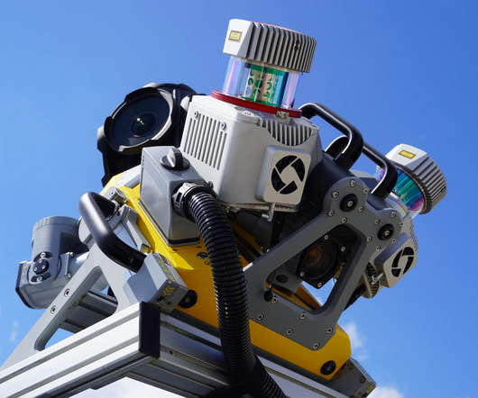
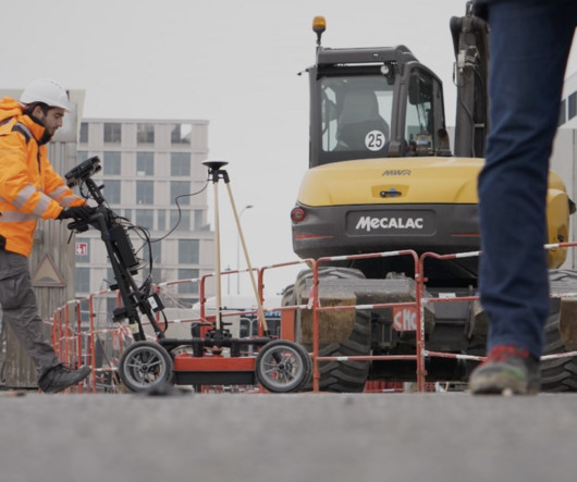
Leica Geosystems, part of Hexagon, today announced the latest addition to its Leica Pegasus TRK portfolio of mobile mapping solutions, the Leica Pegasus TRK100. The new mobile mapping system features the same modular hardware approach allowing users to add more cameras to expand the range of use cases.
Drones are becoming the go-to tool for mapping, inspecting and managing worksites more efficiently and safely. Would your projects benefit from an eye in the sky?
Aerial mapping or aerial surveying is a type of land surveying method that collects geographical information on a construction site or location using airborne vehicles or satellites.
The ResiClub blog put together an interactive map showcasing which counties have seen the largest housing cost spikes from 2020 to 2024. That map shows the biggest home price increases were in smaller housing markets that many people flocked to during the Pandemic Housing Boom, including beach towns, exurbs, and mountain towns.
This Interactive Map Reveals Home Price Fluctuations in Your Local Market ldeakins Wed, 05/24/2023 - 10:09 How is your local market weathering a 2023 housing correction? This map shows how home prices have changed in every U.S. Check out this interactive map to see how your local market is faring.
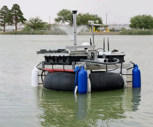
For example, you might want to map a reservoir to learn about water supply for electrical demand, or a river to learn about river evolution or flow patterns.” UTEP alumnus Fernando Sotelo prepares the autonomous boat for mapping Ascarate Lake’s underwater terrain. lead author of the study. “If
Under this contract, the firm will provide flood risk mapping, assessment, and planning services. Additional services under this agreement include assisting with DOW’s goal of two-dimensional (2D) modeling of all the watersheds in the state, which includes hydrologic and hydraulic modeling and mapping. product Flood Predictor.
The British Geological Survey (BGS) has launched hazard mapping tools showing the risk of earthquakes in the UK’s exclusive economic zone (EEZ) to support offshore energy developments. The post Offshore earthquake risk map to support energy developments in UK waters launched appeared first on New Civil Engineer.
The Environment Agency has appointed Aecom, Atkinsréalis, Jacobs, JBA Consulting, Mott MacDonald and WSP Binnies JV to its 2024 Mapping and Modelling Framework (MMF) to aid in decision making related to climate events.
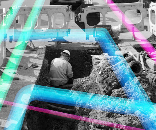
Exodigo , the artificial intelligence (AI) innovator modernizing underground mapping, today announced the close of a $105 million Series A round, converting $30 million previously secured in SAFEs, for a total of $118 million in funding since its launch in 2022. Learn more about recent projects and how Exodigo solves the underground.
The digital mapping system is being implemented on projects delivered through the Repairs and Maintenance Framework with Northumbrian Water Group. Esh Construction has showcased the latest in UK digital mapping innovations on site after helping to shape the technology’s development with Northumbrian Water Group (NWG).
An underground mapping and scanning technology which uses artificial intelligence is being piloted by National Grid in the United States. The post ‘Fusion’ ground scanning technique improves subsurface asset mapping appeared first on New Civil Engineer.
The post Alarming climate risks for English regions detailed in new report and map appeared first on New Civil Engineer. Alarming insights have emerged regarding the vulnerability of various regions in England to climate risks associated with extreme weather events in a study released by AXA UK.
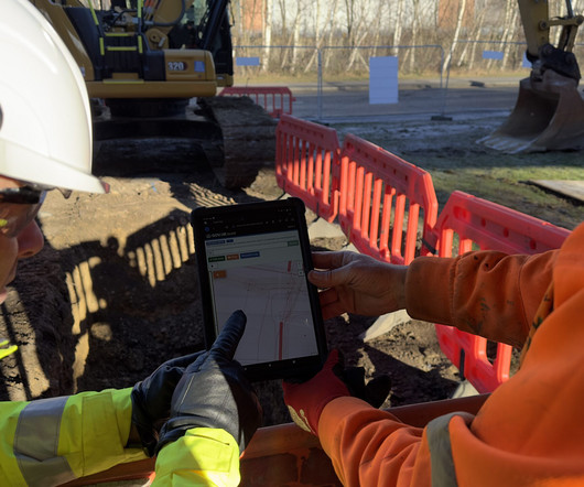
An early version of the new approach to mapping, recording and sharing the location of underground utilities is now live. The post Team behind UK digital utility map give insight into the collaborative project appeared first on New Civil Engineer.
Your financial goals serve as far more than wishful projections; they form the backbone of your road map for success, both internal and external. Setting financial goals for your construction business may be one of your most important responsibilities as a leader and business owner.
The firm provides public sector planning, land use planning, public outreach, entitlement services, civil engineering design, and surveying/mapping to public agencies, developers, and property owners.
The ARC JV, led by Michael Baker International, is under a five-year, $300 million maximum value contract to provide technical expertise across FEMA’s Zone 1, including generating/evaluating flood hazard and risk information, along with mitigation, planning, flood mapping and modeling activities.
Risk Analysis: Mapping the Counties Most at Risk of Increased Home Insurance Costs ibush Mon, 01/15/2024 - 08:03 A look at which counties are expected to face the greatest risk for insurance shocks due to fire, wind, and flood risk going forward California, Florida, and Louisiana are three states in particular that have seen significant insurance cost (..)
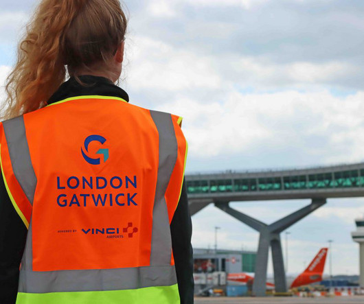
The post Gatwick Airport implements mapping tech to monitor assets and environmental impacts appeared first on New Civil Engineer. Gatwick Airport has developed a cloud-based geospatial data platform to make engineering and construction works safer by reducing accidental strikes on buried utilities.
The Construction Leadership Council’s CO2nstruct Zero task force has published a broadly based route map towards diesel-free operation as part of the wider plan to decarbonise the industry. Construction leaders have committed to eliminate diesel from most sites by 2035. There are presently 300,000 items of construction plant consuming 2.5
Does this sound like you? Maybe you started your company with a few friends and relatives as your earliest clients, and you thought your overhead expenses would be low since you worked out of your home.
The Missouri Department of Transportation said technology such as intelligent compaction, infrared scanning and mapping software vastly improved some of its pavement construction operations.
Mapping Your Journey: The Many Paths to a Career in Construction in India In this comprehensive guide, we explore the exciting landscape of careers in India's construction industry. Whether you are a job seeker or simply curious, this guide is your map to a rewarding future in construction.
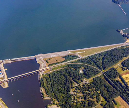
It is a fast and precise way of mapping to support dam managers with assessing the dam face for abnormalities or degradation. The project took 2 days: one day for data collection with DJI M300 equipmed with TOPODRONE LiDAR 200+ and P61 camera & one day for data processing with TOPODRONE Post-Processing software in the office.
Dave Bolcar, NNS vice president of engineering and design, calls MAP-to-E “transformative” as it connects with students in their first year at ODU, guiding them toward success in their studies and rewarding careers at the shipyard. “As We’re designing and building the highest-quality aircraft carriers and submarines for the U.S.
We organize all of the trending information in your field so you don't have to. Join 79,000+ users and stay up to date on the latest articles your peers are reading.
You know about us, now we want to get to know you!
Let's personalize your content
Let's get even more personalized
We recognize your account from another site in our network, please click 'Send Email' below to continue with verifying your account and setting a password.


Let's personalize your content